Tag Archives: travel

The Eruption of Merapi Volcano, 2010

During the whole of 2010, I lived on the island of Java, Indonesia, teaching English in the city of Solo. One of the most extraordinary events during my time there was the eruption of Merapi Volcano, located just 25 miles away from the city. By the time the eruptions ended in December, three hundred and fifty-three people had tragically lost their lives.

**************

23rd October 2010 – Kaliurang

No surprise or alarm had registered on the taxi driver’s face when, emerging from the railway station at Yogyakarta, I’d asked him to take me to the hill resort of Kaliurang on the slopes of Merapi. Having agreed a fair price, we had set off quickly through the heaving traffic that clogs the old city. Only a few hours before, I had been enjoying a quiet and lazy Saturday afternoon at home, when I received a casual text message from Irma – one of the other English teachers. ‘Merapi is erupting,’ is all she had said. Hoping to photograph the notoriously dangerous volcano as it spouted lava down its conical flanks, I had hurriedly packed my rucksack with overnight things, prepared my camera equipment, and left Solo city for Yogyakarta by twilight. As I set off on the train that evening, I had no idea of the chaos and destruction to come.

Locomotive at Solo Balapan Station, Java, Indonesia

Setting off from Solo Balapan Train Station

As we neared Kaliurang, there was a toll booth on the road. I fully expected that we would be turned back for safety reasons. Reassuringly though, I was asked to pay the entrance toll and we were waved on our way further up into the hills.

In the darkness, the taxi driver strained to read the occasional small signs as the road wound up and around the mountainside, passing houses and sometimes small hotels. There seemed to be very little sign of life – no lights on in the small dwellings, and no people on the misty streets. It was very dark.

We pulled up outside a large open gateway and the driver indicated we had arrived. He spoke briefly to a lone policeman who was standing guard, and then drove away.

The policeman looked at me with a mixture of bewilderment and worry.

‘Merapi active! Dangerous!’ he said, with genuine concern.

With a mixture of my pidgin Indonesian and sign language I managed to convey to him that I was going to spend the night there, to try to see the peak and get some photographs. Obviously fearing that if the volcano erupted I might be incinerated during the night and never be seen again, he handed me a form to fill in with my name and address in Indonesia. I gave the address of the English school. There then was some misunderstanding, with the Policeman seemingly trying to restrict me to staying on a small patch of grass by the car park, whereas I wanted to explore further uphill and try to find the observation tower I had heard about. After a while he wandered off, and I got the impression that I was free to go wherever I wanted. However, the encounter with the policeman had sowed a seed of doubt in my mind – his alarm and insistence on getting my name and address made me question for the first time how safe this little camping trip might be. On the other hand, the taxi driver had been unconcerned, and hadn’t I even been charged a tourist entrance fee on the road up to Kaliurang!? There were no road blocks preventing access, so I reasoned that it couldn’t be that dangerous.

Now alone in the darkness, I switched on my head torch and looked around. I did not know exactly where the taxi driver had dropped me, but it was likely I was in the right place – a tourist area where people usually came in daylight hours to get good views of Merapi. In the far corner of the small car park I could make out a stony path leading uphill, and I set out in that direction. Passing a small mosque and a few outbuildings, I could eventually make out the shape of a two storey observation tower looming out of the mist. At the base of the steps up the tower was a small ticket office and a gate. The ticket office was deserted and the gate was padlocked shut. I looked at the tiled flights of stairs which were enclosed by waist-high metal railings. Climbing the stairs on the outside of the banister, I soon realised that it would be awkward but entirely possible to climb over the railings at the first landing and bypass the padlocked gate altogether. It was a struggle with my rucksack and camera equipment, but in no time I had scrambled over and climbed the two floors to the top of the tower.

The tower was hexagonal in shape, and open at the sides. The lights of Yogyakarta twinkled in the darkness, several thousand feet below and to the south. On the northern side, there was a ravine to the left and high forested crags above. Further up the valley and obscured by the clouds was the cone of the Merapi volcano itself. The tower was sparse – apart from a wooden bench on the northern side the only other feature was a small litter bin. Above the bench, fat and menacing spiders sat motionless on their webs. Once my camera equipment was set up on the tripod and my sleeping bag was stretched out on the bench, I hunkered down for the night. There was no wind on the mountain and the air was cool rather than cold.

Lights of Yogyakarta from Kaliurang Hill Resort, Java

The Lights of Yogyakarta from the Observation Tower

In the darkness of the unkempt garden around the tower I saw a flash of light in one of the trees. As I watched, a small green light blinked on another bush nearby. At first I thought I was seeing things, but then I realised the lights could only be the mating displays of fireflies.

I strained to catch a glimpse of the volcano in the gloom, but the stubbornly overcast sky completely hid it from view. It was the evening of 23rd October and the rainy season was well underway, if the sky was going to clear at all it would not do so until the small hours or perhaps not even until dawn. The volcano could not be seen but it could certainly be heard. As I lay there in the dark, the mountain rumbled ominously and cracking sounds rang out as boulders tumbled down the flanks high above.

Elsewhere on the slopes, seismographs in monitoring stations sprang to life as pressure in the volcano’s lava dome rose and the mountain convulsed. I later read in the Jakarta Post newspaper that about five hundred small earthquakes were recorded over the weekend of my visit to Kaliurang – a substantial increase in volcanic activity.

The noise was unsettling to me, alone in my tower. If Merapi were to erupt that night, it would most likely take the form of a pyroclastic flow – a huge cloud of hot ash that would race down the side of the volcano at temperatures of up to 1000 degrees Centigrade and speeds of up to 700 kilometres per hour. The Javanese, with years of bitter experience of Merapi and its eruptions, have a rather quaint name for these pyroclastic flows – gedas wembel which means ‘woolly sheep’ – because of the billowing white clouds that pour down the mountainside. In the rush to get to Kaliurang, I had had no time to read very much about the place, and I began to wonder how far away I was from the crater and how long it would take after an eruption for a pyroclastic flow to reach the tower. I estimated that I was 20 kilometres from the summit of Merapi and that it would therefore take just under two minutes before the searing hot gas tore through Kaliurang. It was only after I returned to Solo that I was able to measure the actual distance from the crater on a map, and I found that the tower was in fact just six kilometres away.

kaliurang

The Observation Tower at Kaliurang – My camp for the night.
[Photo by elsa200530, via flickr]

In the small hours of the morning, the cloud thinned out just sufficiently for me to see the black cone of the volcano rising at the head of the valley. Immediately, I was disappointed to see that there was no sign of any lava and not even a red glow from hot rocks at the summit. Within minutes, the mist had closed in again and the darkness had swept back like a cloak.

After a night of fitful sleep on the bench, the pale light of dawn crept into the valley. There was no sign of the mountain peak which remained wreathed in cloud. A few hours later and some tourists began to arrive. There were other signs of life too, as a local woman arrived and opened up the warung (hot food stand) in the car park. As the resort awoke and came to life, the isolation and strange atmosphere of the previous night receded, but so too did my chances of getting a photograph of the volcano erupting. I made my way down from the tower, paid for my stay at the ticket office and walked downhill into the village in search of a bus back to Yogyakarta. I didn’t know it at the time, but I was far from finished with Merapi. Its geological temper tantrum had only just begun.

**************

 On the Monday, a day after I left Kaliurang, the Indonesian authorities raised the alert status for Merapi to its highest level and warned villagers living within ten kilometres to evacuate. As daylight faded on Tuesday 26th October 2010, Merapi finally erupted and thousands of people were evacuated from its slopes. Thirteen people died in the initial eruptions and many more suffered severe burns due to hot ash.

Over the remainder of that week, it seemed that Merapi was returning to a more usual pattern of behaviour – milder eruptions that were characterised by lava flowing down the flanks of the mountain and easing the pressure inside.

During my breaks from teaching, I would often read the local and national newspapers which had photographs of Merapi. There were often similar, but incredible images of orange lava cascading from a deep central crack in the side of the peak, lighting up the clouds at night. This was exactly the kind of photograph I had hoped to take in Kaliurang. Looking at the captions underneath these photos, I noticed they all had one thing in common – they had all been taken in, or near, a village to the south of the volcano called Cangkringan.

It was too tempting for me, I would have to make the journey to Cangkringan and see if I could finally succeed in photographing the lava.

**************

Friday 29th / Saturday 30th October, 2010 – Cangkringan

Lightning flashed above the fields of maize and rice, illuminating the palm trees and the leaden, overcast sky. With the taxi window down, the steady pulsating hiss of insects could be heard even above the noise of the engine.

On this trip to Merapi, I had even less idea of where I was going. I had simply asked the driver to take me to Cangkringan and tried to make it understood that I wanted to try to photograph the peak. I had no idea where I would be dropped off, or what I would find when I got there.

Eventually the taxi stopped on a quiet road and the driver gestured for me to get out. As the car pulled away, I switched on my head torch and looked around. The first thing I saw was not very reassuring – a malaria or dengue fever clinic! It was a small, square building with a rather menacing mural of a mosquito on it. Near the clinic was a stone Indonesian-style gateway and beyond that there seemed to be a path leading into a village. If this was Cangkringan – or at least, a village near Cangkringan, then I would need to head due north to have any chance of a view of the mountain. A quick check of my compass confirmed that the little path would take me in roughly the right direction, and I set off.

The path was soon surrounded by small houses. They were simple single-storey affairs with tiled porches and neat yards. It was very quiet and there was nobody around. As I crept along the path I dreaded that a dog would bark and wake the whole village, or worse, attack me. However, I needn’t have worried as it seemed that all of the residents of this anonymous hamlet were fast asleep. At the top of a short rise, the path reached a T-junction. To the left, it dipped down hill, crossed a bridge and beyond that the countryside seemed to open out into paddy fields. That was clearly the direction to go in.

I found myself next to a paddy field that had a small concrete hut in it, just off the path. It seemed the perfect place to make my camp. There was a small pile of vegetation and other rubbish in one corner, so I checked that carefully for snakes before settling in. The hut had very large openings on all sides, so I could easily look all around without moving from my seat on the floor. I set up my telephoto lens on its tripod outside the hut, just in case the sky should clear and give me the view of Merapi that I had come for. The skies remained stubbornly and solidly overcast. There were loud booms and I could not tell if these were thunder, or if they were explosions coming from the killer mountain in the clouds above. I would soon have my answer.

As I sat in my hut, looking out across the dark paddy fields it was very quiet. Occasionally I could hear some very faint music or a radio away to the north. Just like in Kaliurang, I periodically saw green flashes from fireflies as they darted about outside. I managed to catch one of the little insects and found that up close, it was just a dull brown beetle.

I had not been in the hut long, and from memory it was about one o’clock in the morning, when ash began to fall softly from the sky. It was very much like snow as it fell all around. I got up from the hard concrete and went outside. It was then that I did something very stupid indeed – I looked up. A particle of the volcanic ash landed in my eye, and its sharp edges were incredibly irritating. It took me a while to get it out, and even then my eye was sore.

The volcano had obviously erupted, probably around the time I had arrived in the paddy field. Now that the ash was falling, people from the nearby village came out from their houses to have a look. The first was a middle-aged man on a motorbike, who rode right up to the little hut. He was wearing a dust mask over his mouth and nose. Initially I was concerned at what he might say or do. How would he react to finding a foreigner sleeping rough in a paddy field near his house? As it turned out he said nothing. We nodded at one another, and that was all. Before long we were joined by perhaps ten other dust-masked villagers, who also said nothing – either to me or one another. So we all stood in an eerie and rather surreal silence, gazing into the distance to the north. I remember looking enviously at a glass mug of tea that one of the villagers was holding. It had been many hours since I had anything to drink and I was already very thirsty.

One by one my visitors filed away, back to their homes. I sat down again on the concrete floor of the hut, and wrapped my arms around my sides for extra warmth. I found that I was in the exact same position when I woke up hours later, at first light.

Seemingly against all odds, the sky had now cleared and Merapi was visible, albeit wreathed in mist and low cloud. A column of ash was rising from the summit cone, but in the daylight there was no sign of any lava. I considered myself lucky to get any sort of view of the mountain in the rainy season, and took several photos of the smouldering giant on the horizon.

Eruption of Merapi Volcano, Java, Indonesia 2010

A View of Merapi Erupting, Seen from Cangkringan

Merapi Volcano Erupting, As Seen From Cangkringan, Java

Merapi Volcano, viewed from Cangkringan

As I was preparing to leave, I saw a man with a long thin stick approaching through the field. He was guiding a large flock of runner ducks in front of him, that were quacking noisily. We exchanged a nod and a smile as he passed by and then I packed up my camera equipment and walked back through the village. It is amazing the difference that daylight makes. What had seemed like an eerily quiet and strange place the night before was now a charming hamlet with concrete fish ponds, nice neat little houses and lush green trees.

I made my way back to the main road, past the building with the mosquito mural and walked south until I came to a bus stop. I didn’t have to wait long for a bus to arrive and I made the short journey further south to the main Yogyakarta – Solo Road. We stopped across from the famous Hindu temples at Prambanan and from there I took an extremely crowded bus back to Solo. Occasionally I caught a glimpse of Merapi in the distance, billowing smoke and ash.

I was disappointed that I hadn’t seen or photographed the lava, but it had been an amazing experience to spend the night in that paddy field and experience the eruption.

**************

Shortly after I had arrived in Solo in January of that year, I had joined the Solo Expats Association (SEA). The SEA was often involved in charity work and with the death toll from the eruption rising, it was strongly felt that we should organise some help for the people living on the slopes of the volcano. We came to the view that with the army helping the most badly affected villagers on the southern flank of the volcano, we should concentrate our efforts on helping the people in the village of Selo to the north, who were perhaps a bit neglected at that point. The SEA also had a connection to Selo – a previous member of the SEA had left the association a house in Selo when she left Indonesia. It was sometimes used for weekends away and barbecues, but now it would become a makeshift aid distribution centre.

Sadly, I wasn’t able to go up to Selo on the first weekend aid run. I had promised to take my girlfriend up to the hill resort at Tawangmangu for a day out. By the time of the next aid run, on November 13th, I was eager to get involved.

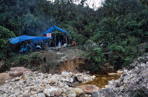
We all met up early in the morning at Manir’s Happy Restaurant in the Manahan area of Solo – one of the regular haunts for us expats. Manir is a kind and softly-spoken Bangladeshi, and well known for his excellent chicken dopiazas. The scene that morning was fairly chaotic, as large piles of food, bags of rice, cooking oil, ready-to-eat meals, water and packs of nappies (diapers) were loaded into pick up trucks for the journey to the SEA house in Selo. I was looking forward to the drive because I had not yet been out of Solo in that direction.

We set off in a small convoy and made our way out past the airport and through the town of Boyolali – a place famed for dairy farms. As we climbed up towards the town of Selo, we began to see army vehicles parked at the side of the road, and red signs in Indonesian that said ‘Caution: Natural Disaster’. Soon there was a significant amount of ash coating the road and the countryside – it was obvious that we were getting closer to Selo and Merapi.

Ash from Merapi Coats the Road to Selo, Central Java

Ash from Merapi Coats the Road to Selo, Central Java

At last we entered Selo itself. It was a small town clinging to the flanks of the volcano. It had been blanketed in grey ash which had coated the streets, the roofs of the houses and, more importantly, the crops that the villagers depended on.

Ash from Merapi Covers the Fields and Houses at Selo, Java

Fields and Houses Covered with Ash at Selo, Java

The SEA house was a fairly spacious bungalow with a small garden containing some maize plants and some coffee bushes. It seemed that nobody had been in the large living room for quite a while, and it smelled slightly damp and musty.

We set about unloading the trucks from our convoy and stacking the goods neatly around the living room. In no time at all a steady stream of villagers started to arrive. I had been a bit concerned that there might be a scrabble for the aid and perhaps some pushing, shoving and frayed tempers. In fact, everyone calmly and patiently waited for their turn to pick up what they needed. Apparently the RT (head man) of each neighbourhood was organising who got what. Many of the villagers tucked in to the ready-to-eat meals we had brought with us and the children particularly enjoyed the apples we gave them.

Solo Expats Association Distributes Aid to Merapi Refugees in Selo

Unloading the Aid at the SEA House, Selo

I was surprised to learn that a reporter from TV One News had come to get some footage of the SEA aid effort, and later in the afternoon he interviewed Anne, a fellow teacher who worked with me at the English school in Solo. In the end we did appear in a report on the national Indonesian news.

The Children Were Very Grateful for the Apples

The Children Were Very Grateful for the Apples

**************

The second and final aid run (on December 4th) was very similar to the first, except this time we went to a small village called Sepi. Once again, this was on the northern flank of Merapi. As our little convoy of flat-bed trucks climbed up the mountain past very steep terraced crop fields, we got a dramatic new sense of the violence of the events that had taken place here. I noticed that several very thick bamboo stems (so thick they would typically be used to make scaffolding for construction work in Solo) had been smashed almost in two. Whether this had happened due to a pyroclastic flow I did not know, but it seemed that flying boulders were a more likely culprit. Whatever had caused it, it was a very sobering sight.

Once we arrived at Sepi, I was amazed by the amount of grey volcanic ash that carpeted everything in view. As I climbed out of our truck, my boot made an impression in the dust that immediately reminded me of the famous photograph of Neil Armstrong’s boot-print on the surface of the moon!

At a house nearby, two children were shovelling ash from the roof of the house into a hessian sack, and then pouring it on to the ground below. They were smiling and laughing despite the gruelling work and the damage that the eruption had done to their house. With their permission, I went inside, and through to the rear of the property where the shear weight of the ash had collapsed the roof, leaving just a bare light bulb dangling above the rubble.

Children at Sepi Clear Ash from Merapi From the Roof of Their House

Children at Sepi Clear Ash from Merapi From the Roof of Their House

This Roof Collapsed Due to Volcanic Ash, Sepi Village, Java

This Roof Collapsed Due to Volcanic Ash, Sepi Village, Java

We were soon handing out our cargo of vital supplies for the villagers, as well as sweets and lollipops for the children. Everyone was pleased to see us and grateful for the items that we had brought up from Solo, purchased with money that had sometimes come in from around the globe.

Solo Expats Association Giving Aid to the Children at Sepi, Java

Solo Expats Association Giving Aid to the Children at Sepi, Java

As we worked in the cloud and mist, it was a reminder of the tremendous difference in climate up here, which was cool compared to the sweltering plains below. The volcanoes of Java may sometimes be destructive, but their terraced slopes enable the villagers to grow an incredible variety of crops. Not just fruit and vegetables, but also valuable commodities such as tea, coffee and cocoa (chocolate). Eruptions may sometimes bring death and tragedy, but they also provide extremely fertile soils which sustain agriculture and ultimately the population.

We bade farewell to the villagers of Sepi, and headed back to Solo. It seemed odd to me that even though Solo was not far from the volcano, the only sign of any volcanic activity that we had seen in the city was an occasional sprinkling of dust on parked cars. It was hard to believe that such a dramatic and dangerous event had taken place nearby, especially one that had taken so many lives in a very short time.

**************

Even though I only lived in Indonesia for a year, the Merapi volcano eruption was not the last one I saw. Bromo volcano (which I had visited earlier in the year) also erupted during my stay in Java. Although I did not see the eruption up close, I did get to witness the huge cloud of dust from the volcano as my friends and I drove back from a visit to the Sukamade turtle beach on Christmas Eve.

**************

To see all of my photographs from the Merapi Eruption of 2010 and the SEA aid operation, please visit my flickr album .

If you would like to read about more of my travels and see more of my photographs, please visit my website at www.rowancastle.com. Thank you.

All words and photographs by Rowan Castle unless stated otherwise. Copyright 2016.


Climbing Pico da Neblina – Brazil’s Highest Mountain

Little did I know when I set out for Pico da Neblina that during the climb I would have one of my most surreal travel experiences ever – and it was all because of my haircut………..

Imagine a mountain that soars straight up out of the Amazon rainforest to a height of nearly ten thousand feet, and so remote that it was only discovered in 1953. Almost perpetually shrouded in cloud and mist, few people have seen it and it has never been mapped. Cutting it nearly in two is an unexplored canyon which is believed to be among the deepest on earth. It may sound like the setting for a fictional Hollywood movie but, this is Pico Da Neblina, the highest mountain in Brazil. This incredible peak stands right on the border between Brazil and Venezuela, in the lands of the famous Yanomami Indians, who until as recently as the 1970’s, retained their stone age culture and lived naked in the forest.

When I first read about Neblina, it seemed that the difficulty of getting there made it off limits to anyone other than government sponsored botanists who were lucky enough to be helicoptered up to the slopes (60% of the plants there are new to science). Back in 2002 however, one UK adventure travel company ran a trek to the summit, and I joined the trip.

After flying to the Amazonian town of Sao Gabriel da Cachoeira via Rio de Janeiro and Manaus , we travelled by boat and on foot through the jungle. Pico da Neblina lies in the Pico da Neblina National Park, a protected area which is home to many rare birds and animals. During our boat journey to the foot of the mountain we were fortunate to see giant otters, macaws and rare pink river dolphins. I will pick up the story of our trip at the point where, after a long and steep climb through the jungle, we reached the base camp of Pico da Neblina. This account is taken from the diary I kept at the time.

I reached the Base Camp with Valdir (our guide), slightly ahead of the rest of the group. There were a couple of existing frames for the shelters in place, and the porters had already set up blue tarpaulins over one of them to form the kitchen area. The camp was located in a very pretty spot, at the junction of two small creeks. It was obvious that gold miners had previously used the area, because there were signs of old shelters and the ground had been stripped down to the quartz gravel underneath. However, beyond the small clearing of the camp was an incredible landscape of rocky outcrops, carpeted with palms, bromeliads and other strange plants. It really was a ‘lost world’ and I half expected to see a dinosaur at any moment! I set up my tripod and took a couple of photographs of the camp, before James (our UK guide) came down the trail. He told me that he and Bill (a trekker from the USA – one of our group) had discovered a beautiful orchid near the path and that I might want to come and have a look. After a few minutes of searching, we found the right spot. Sure enough, there was an orchid growing there with three small but stunning flowers. It has been estimated by botanists that sixty percent of the plants on the slopes of Neblina are unique to the area and new to science.

Base Camp, Pico da Neblina, Brazil

Base camp of Pico da Neblina

Beautiful Orchid, Pico da Neblina, Brazil

Beautiful orchid at Base camp

After I had set up my hammock in camp, I set off to explore the gully formed by the larger of the two creeks. It seemed that this small river was actually the beginnings of Tucano Creek that we had navigated earlier in the boat. A path led a short distance along the left hand bank, but after that the going was far from easy, and I found myself clambering over many large boulders. In the dense undergrowth on the high banks above the creek, I occasionally saw hummingbirds searching for flowers. Within a short distance from the camp, I found a second orchid. It was not as spectacular as the one that Bill and James had discovered, having only small yellow flowers.

After picking my way over and around the rocks, I discovered that the creek widened into a beautiful and secluded area where the clear water flowed slowly past a wide sandy shore. There were several flower-covered bushes on the banks of the stream, and after a few minutes a dazzling green hummingbird with white outside tail feathers flew in to feed on the nectar. It was a magical spot, and I re-visited it several times before nightfall to show some of the rest of the group.

Back in camp, Graham and I were chatting before dinner, when a green hummingbird with an iridescent blue throat flew into our shelter. It buzzed round our heads for a few seconds and then flew off. We learnt that the hummingbirds in the area are fairly tame because they have seen few humans. Also, the gold miners that live on the mountain have made a habit of feeding them and so they associate people with food. Valdir had filled a plastic mug with sugar-water and hung it up on a nearby branch. The local hummingbirds took full advantage of this free source of energy and quite often perched on the cup to feed.

Day 8 – Saturday 14th September (Summit Day)

The whole group was awake at 05:15 to ensure an early start for the summit climb. We had a hurried breakfast, and in the pale dawn light Valdir gave us a briefing on the climb ahead. He explained that there was a creek that had to be crossed during the trek up the lower slopes, but it could not be forded after heavy rain. This meant that if it started to rain heavily while we were high up on the mountain, we would have to race back down to base camp to avoid being stranded. He expected that reaching the summit and getting back to camp would take at least twelve hours and it would be important for us to keep up with his pace if we were to make it back before dark. Brian (another member of our group) announced that he would not be going with us to the summit, because he didn’t feel like it and would rather spend the day exploring the base camp. Naturally, we were all sad that he wouldn’t be climbing with us, but respected his decision. Before we set off, Bill rummaged in his backpack and gave each of us one of the power bars that he had brought with him from the US. It was very generous of him, and was a welcome boost to our energies before what was sure to be a testing day. Each of us took only the absolute basics with us on the trek to the summit – a water bottle, waterproofs and our cameras. I also opted to take my GPS receiver with me, because I wanted to get an accurate fix of the position of the summit.

Pico Da Neblina - Brazil's Highest Mountain

A rare view of Pico da Neblina, from base camp

We set out at 06:40, briefly retracing our steps back along the trail, before following a left hand fork towards Neblina. This first took us through an area that had been heavily excavated by gold miners and then plunged into a four hour stretch of thick mud and tangled roots. There were high earth banks to each side, and dense vegetation on top of these, so that we were trekking along corridors through the foliage. Some of the mud pools here were more than knee deep and it would have been so easy to break an ankle on the hidden roots and rocks. Sometimes our legs sank deep into the black mud and it was so thick and viscous that it was a struggle to break free. Another hazard were roots that had been chopped through with a machete to clear the path. The cut ends of the roots were often very pointed and if not seen in time they smashed painfully into a knee or a thigh.

Reaching the creek that Valdir had warned us about, we found that fortunately it contained very little water and was easily crossed. The banks of the stream were crowded with vegetation, including a shrub-like plant with many beautiful small pink flowers. After re-filling our water bottles we continued along the muddy path.

At this point Valdir had gone far ahead, I was trekking a little way behind David, and James was back at the tail of the group. I came round a bend in the track to find that it forked. I was just in time to see David about to disappear out of sight along the left hand fork, but I noticed that someone had bent two thin saplings across each other at the mouth of that path to form an ‘X’. These indicated that the left fork was not the way to the summit. It was a subtle sign that was easy to miss, and David must have walked straight past it. I called out to him and he rejoined me on the correct path. It was lucky that I saw him when I did. After this incident I was rather concerned about how easy it was to lose the way and decided that I would make an effort to catch up with Val at the front. It was hard work to put on extra speed through the thick mud but I made it. Walking behind Val seemed to make the climb easier, because he knew the terrain so well. I reasoned that if I stepped where he stepped and kept to his pace, I would have a good chance of making it to the top and back down safely. We were also fortunate in that James and Val were equipped with two way radios so that they could communicate fairly easily, even over some distance, and keep the group together and on track. One consequence of moving to the front of the group and trekking with Val was that I missed an interesting discovery by James and Bill. They came across a small black scorpion resting in leaf litter at the side of the trail.

Valdir, Pico Da Neblina, Brazil

Valdir uses the two-way radio on the summit climb

Having reached the end of the muddy section, we could see that the path climbed extremely steeply up a cliff face. It was quite exposed in places, and several short sections were actually basic rock climbs or scrambles. At one point in the climb a trio of Scarlet Macaws flew past at eye level, giving us a welcome distraction from the drop off nearby. I found one small rock chute particularly difficult to climb, because the handholds were far apart and slippery because of the water and algae on the surface of the stone. At another, there was a permanently fixed knotted rope that allowed us to haul ourselves up. This section of the climb was incredibly demanding, and there was no let up in either the pace or the steepness of the ground.

After the cliff came an easier (but still steep) section over quartz rocks. The plant life here was very interesting; we saw a beautiful orchid, carnivorous pitcher plants and another interesting insect-eating plant, the bladderwort. The bladderworts on Neblina grow in the small pools of water that collect inside bromeliads. Once established they send up a single green stem, topped with a beautiful lilac flower. The roots that grow inside the pool of water have little sacks (bladders) on their ends. The plant pumps the water out of these bladders to create a partial vacuum and when a tasty morsel floats close by, a trapdoor opens in the bladder and the insect is sucked inside to be digested. We took a rest at this point, while we examined the interesting plants. Unfortunately, I had put my camera away and so missed the chance to photograph a beautiful hummingbird that perched on the branch of a small tree, just feet away from us!

Eventually, we reached the foot of some formidable looking cliffs and had our lunch while perched on a steep bank of rocks. Looking at the way ahead, I was beginning to wonder if I was going to make it to the summit. By this stage, Carolyn’s knees were hurting badly, so she and Del decided to go back. Tomei, one of our Yanomami porters helped her all the way back down to the base camp. That left four clients, Bill, David, Graham and I, plus Marcello, Valdir and James, to push on to the summit.

Just after the lunch stop we came to an almost sheer rock face some twenty feet high that was safeguarded by a knotted rope. I climbed up very carefully, trying hard to keep a tight grip on the sodden and slippery rope. When I got to the top I found a narrow ledge with a nasty drop off to the left, and I rested against the rock while I got my breath back.

Scramble to the Summit, Pico da Neblina, Brazil.

A photo of me climbing the fixed rope on the way to the summit

Next to me on the ledge were the troops from CIGS – an elite Brazilian army jungle warfare unit who were on their way back down from the summit, having completed their annual repairs to the Brazilian flag. They were waiting patiently for us to ascend before they could use the rope to get down. When the others in our party reached the top, Valdir told me that the leader of the Brazilian army unit wanted to talk to me and pointed him out. I made my way over somewhat nervously; why on earth would he want to speak to me? The army man spoke briefly to one of his sub-ordinates, who to my amazement began cutting the Brazilian flag from his uniform. The leader then presented this to me, with a salute. By now I was totally confused, and so I just saluted back and thanked him. They made their way down the rope, and I turned to Valdir in the hope of an explanation. Apparently, the leader of the army group had seen my very short haircut (a number 3) and had assumed that I was in the UK army. He had decided to give me the Brazilian flag from the uniform as a goodwill gift. I was amazed, and I still have the army patch that he gave me.

Brazilian Jungle Warfare Unit, Pico da Neblina, Brazil

The Brazilian Army CIGS jungle warfare unit – this photo was taken just before or after they gave me the shoulder patch. Photo courtesy of Bill Scroggie.

From this point the path to the summit was a very steep rock scramble that was exposed in places. Fortunately, we were now among the clouds and they shielded us from seeing just how nasty the drop-offs probably were. Everyone was very tired, and wondering how much further there was to go, when we finally sighted the Brazilian flag fluttering above the summit cairn. A few minutes later, and we stood on the roof of Brazil, at 9,888 feet (3014 metres) above sea level. As I reached the top  I shook hands with Valdir and as each member of the group joined us, we congratulated each other on completing such an arduous climb. I marked the position of the summit on my GPS receiver and then we took group photographs next to the flag. Each of us signed the summit book, which Brasil Aventuras had placed underneath the summit cairn in a Tupperware box.

We spent about one hour on the summit, during which the dense cloud that surrounded us parted briefly only once, to reveal a memorable view straight down onto the canopy of the Venezuela rainforest on the other side.

Me on the Summit of Pico da Neblina, Brazil

Me, on the summit of Pico da Neblina – Brazil’s highest mountain

Then began the long down-climb back to our camp. It was very difficult to make our way down over the slippery rocks, and of course this time we were facing the drop-offs, which made it more unnerving. I had particular problems on one steep section not far below the summit, and James took my camera and helped me to find sturdy foot and hand holds. When we reached the knotted rope down the rock face where we had met the soldiers, I went down first. It was more frightening to descend than it had been on the way up, because I had to lower myself backwards and the rope was very difficult to grip. I wasn’t surprised when Graham asked James to belay him with the safety rope as he came down after me.

We had a rest stop by the foot of the crags, in exactly the same place where we had lunch. I took a photograph of James next to the precipice, with neighbouring mountains as a backdrop. From this vantage point we could just see the lip of the Rio Baria canyon, the deep and unexplored rift that cuts right into the Neblina massif.

When we reached the treacherous cliff section, it was my turn to ask to be belayed with the safety rope, to help me descend the awkward rock chute that had caused me such difficulty on the way up. I remember another tricky part of the cliff very vividly. It was another short scramble down a rock chute, onto a very narrow path next to a big drop off. We had to climb down this facing the rock, and the very last section was an awkward step backwards off one of the footholds. As I stepped down, I overbalanced backwards and stumbled towards the drop. Luckily for me, Valdir was watching my descent closely, and as I stepped back, he put his arm out behind me and stopped me falling off the cliff.

When at last we reached the foot of the cliff, it was time to retrace our steps through the seemingly unending mud pools and roots that lay between the camp and us. By this time we were all exhausted, my knees hurt with every jar from a submerged rock or sharp contact with the end of a root. It really was difficult at times to summon the energy to lift my feet out of the black mud ooze.

Exactly twelve hours after we had set out to the summit, we returned to our base camp. Brian, Carolyn and Del all came out of their hammocks to congratulate us and Brian passed around a very welcome hip flask full of Scotch whiskey. I was shattered after the climb, which was definitely the most demanding I had done. I had just about enough energy to re-arrange my pack and eat my dinner of potato, rice and vegetable stew, before heading to my hammock for some much needed sleep.

Day 9 – Sunday 15th September (Rest Day)

It had been an uncomfortable and chilly night in the hammock, with a cold persistent wind blowing in under the tarpaulin. I had breakfast, with delicious hot chocolate, and then I took my camera, zoom lens and tripod down the creek to the magical spot I had found before. This was our rest day after the summit climb, and I had decided to spend the morning relaxing by the creek and trying to photograph the hummingbirds feeding on the flowering bushes. It was the hope of being able to photograph hummingbirds in the wild that had led me to bring along my tripod and zoom lens in the first place, and make the effort to carry them all the way up through the jungle. I soon had my equipment set up as close to the nearest flowering shrub that I could find, and then it was just a matter of waiting patiently. I had read that hummingbirds are very territorial and must feed constantly to stay alive, so I reasoned that I would have a fair chance of capturing one on film. In the end, I discovered that a hummingbird (perhaps the same one) visited this particular bush roughly every half an hour. Even with the modern features of my camera such as fast auto-focus and a high shutter speed it was very difficult to photograph these extremely quick and agile birds. The action head on my tripod proved indispensable. It looks a bit like the brake on a bicycle handlebar and with one squeeze of the lever the head and camera can be swiveled to the desired position, but as soon as the pressure is released it locks solidly in place. This allowed me to quickly follow the bird as it darted around the flowers and fire the shutter as soon as the head was locked in place. It took me the whole morning and an entire roll of film to get a handful of shots that I thought might have worked. Fortunately when I was back in the UK and had the slide film developed, I found that the results from a few of the shots exceeded my expectations. I thoroughly enjoyed that morning by the creek, and it was impossible to tire of watching these dazzling little birds.

Hummingbird

A hummingbird near base camp

I got back to the camp just in time for lunch. As we sat around on the log benches next to our camp a hummingbird flew up to us, and fed from the plastic mug of sugar water, often when one of us was holding it! One bird flew right into the middle of our group, hovered, and looked at each one of us in turn before darting away.

A few of the others in our group had spent the morning up at the gold miners camp. They told me that the miners had been very hospitable and even given them some food. Unfortunately, the only thing that they had to offer was a lump of animal fat that they heated over the fire. Bill told me that during the cooking process, it quite often caught light and had to be hurriedly extinguished. Bill had done his best to eat it, not wanting to appear ungrateful, but said that it was almost inedible. Apparently the miner’s camp only consisted of a pole shelter like ours, but with blue tarpaulins on all sides to try to keep out the wind. They had rigged up many sugar feeders for the friendly hummingbirds, which were constant visitors. The miner’s had been enduring these extremely tough living conditions for eleven years. They had so little that they used notebook paper to roll cigarettes. While I was at the base camp, the three miners paid us a visit, and even showed us their precious stash of gold dust.

A rainstorm blew in, the others retired to their hammocks, while I sat by the fire in the kitchen part of our shelter, drinking cappuccino and chatting to Val. While I sat there, a hummingbird flew in and tried to drink from my mug of hot cappuccino! Then it moved on to trying to sip sugar from the lids of the bottles of juice that we had. Val and I had to wave it away from the juice bottles, because whoever bought the supplies had mistakenly got us diet ones for the trek and these would be harmful to the hummingbird, because the artificial sweetener would not give it the energy it needed to survive. These birds require so much energy just to stay alive that they live constantly on the brink of disaster, and I remember seeing a documentary that showed they could only afford to stop feeding to go to sleep at night because they slow their metabolism right down when they roost.

As the rain cleared I watched Val tidying up and doing tasks around the camp. His jungle skills were remarkable. With a machete, he cut a nearby piece of wood to the right size and within a few seconds had shaped one end to make a new handle for our shovel. It fitted perfectly into the shovel-head at the first attempt. When we had been trekking, I had seen him draw and throw his survival knife in the blink of an eye, and he buried the blade right up to the hilt in the stem of a banana tree.

My most remarkable encounter with the hummingbirds happened that afternoon. I decided to sit out on one of the log benches and hold out the blue mug full of sugar water, in the hope that one of the birds would feed from it. I had quite a long wait, but eventually, one came down and actually perched on my thumb as it drank from the mug! It was so light that there was hardly any pressure from its little feet on my skin. I could feel the down draft of air from its rapidly moving wings. It didn’t settle down completely, presumably in case it felt threatened and decided to make a quick getaway. After a few memorable seconds it finished drinking and flew off to the safety of a nearby branch.

We were all very glad that we had been given the chance to spend a day in this incredible and remote place, and we also needed the recuperation time. My legs and knee joints ached terribly from the descent the day before, and it was the first time I had experienced anything like it, even after a long trek. Walking any distance around the camp required a lot of effort.

After dinner, I was glad to retreat to my hammock once more, but it was not a peaceful night. The temperature dropped considerably and a gusty wind buffeted the shelter. I found it very difficult to sleep and couldn’t wait for the sun to rise, but I was pleased that I had made it to the summit of one of the World’s most remote mountains.

It should be mentioned that this was not the last ‘highest summit’ for Graham from our trekking group. Years later he went on to summit Mount Everest from the Chinese side – an incredible achievement.

Memories of the Swat Valley, Pakistan – 1996

The Swat valley has hit the headlines in recent years for all the wrong reasons. It was overrun by the Taliban until an offensive by the Pakistani Army drove out the militants in 2009. However, in years gone by the Swat Valley was a hot spot for  tourists (both Pakistani and foreign) drawn there by the incredible mountain scenery.

Although the Swat Valley is slowly recovering, it is still pretty much off-limits to foreign tourists. I was privileged to visit in 1996 during an eight-week backpacking trip from Mumbai, India to Peshawar in Pakistan. This is an account of my visit, with photographs that I took at the time.

Saturday 17th August 1996 (Day 45).

I left the hotel early, eager to escape the heat and get up into the cooler climate of the Swat valley after the extreme heat of the southern Punjab and Peshawar. For the first stage of the journey I took a rickshaw to the General Bus Stand where I boarded a wagon that was heading for the twin towns of Saidu Sharif and Mingora, which have merged to become one town.

We headed east down the Grand Trunk Road and then north through the small town of Takht-i-Bhai; where a small group of men were loading large bails of dried tobacco leaves onto waiting trucks. From there the road climbed sharply up into green bush-covered mountains to a height of about three thousand feet allowing spectacular views of the Vale of Peshawar. At the top of the climb we crossed the MalakandPass and gradually descended into the lower Swat valley. Even from that point it was still a fairly long drive to Mingora, and the road passed through an area which contained many important Ghandaran Bhuddist sites. We saw one site, the large Shingerdar Stupa, from the wagon as we drove past. It was a large dome of red-brown bricks with many shrubs sprouting from the top. The river and the valley itself were only occasionally visible through the trees but they were an impressive sight. At this point the river had spread out across the valley in a great grey sheen; the colour was caused by the large amount of sediment carried down from the mountains in the water.

At the bustling and congested town of Mingora I changed wagons, climbing on board one that was heading for the tiny town of Madyan, much further up the valley. As we drove higher up the valley side the scenery became more and more dramatic and by the time we had arrived in Madyan, my final destination for the day at about 4000 ft, the air had become cooler.

Madyan, Swat Valley, Pakistan

The Town of Madyan, Swat Valley, Pakistan

The wagon dropped me in the middle of a very small bazaar and I carried my pack a short  distance to the north, along the muddy street and over a bridge to the Nisar Hotel. After a brief rest I set off with my camera to walk up the Madyan Khwar, to a meadow area called Chil. The Madyan Khwar is a side valley that runs east out of the little town (the bridge that I had crossed on the way into town spanned the river emerging from it). My guide book claimed that the walk took only a few hours and was safe. Initially I found it difficult to find the start of the small path up the south side of the valley, but eventually I realised that it began in a dingy alley leading out of the bazaar. This soon emerged onto a wide stony track and I found myself walking with a Pakistan Fisheries worker who told me that I was going in the right direction and, as we climbed further up, he pointed out the trout farms where he worked that were down by the riverside. Close by was a set of steps that lead down to a restaurant housed in a smart wooden building with a beautiful garden.

The Trout Park Hotel and Restaurant was spectacularly sited on an outcrop by the river side. The garden was cool, green and criss-crossed by gurgling irrigation channels and behind the hotel the mountains soared skywards, thickly covered in Indian Deodar trees. The meal I had was good and was washed with bottles of Sprite with small lumps of ice in them. It was exactly the sort of place I had day dreamed about as I had sweltered in my hotel room in Multan. I was joined by two Pakistani tourists who were about to return to Peshawar after a holiday in the Swat valley. They invited me to have some of their tea and we had an interesting conversation. One of the two men was a civil court judge in Peshawar and I had thought that perhaps with his knowledge of the area he could tell me if the Khyber Pass and the gun village of Darra Adam Khel would be open to tourists or not. He said that the Khyber Pass would probably be open and that Darra Adam Khel definitely would, in fact he said that the village was totally safe. However, he confirmed the advice given in my travel guide that visiting the areas of the Swat valley north of the little town of Kalam (where I was heading next) was not safe without a trustworthy local guide.

I thanked them for the tea and continued my walk up the valley. I was very cautious throughout my walk, aware that the inhabitants may not have been friendly as I came upon each little group of houses. As it turned out, I had no need to worry, the Pathans who lived in this part of Swat were all extremely friendly, and by the end of my walk it seemed like I had said hello to, or shaken hands with, almost everyone who lived there. The short trek was idyllic as I made my way first up one side of the noisy rushing river, then the other, through the green fields of maize. The mountains above were still forested, and small wooden houses clung to their lower slopes. When I reached the furthest point that I could get to that would allow me time to return to Madyan before nightfall, I checked the altimeter on my watch. It was showing a new record for the journey of 5,580 feet. At this point I took off my boots and socks and dangled my feet in the river in a deep pool that was refreshingly cold. I could have stayed there for hours but nightfall was getting closer.

Madyan Khwar, Madyan, Swat Valley, Pakistan

Walking up Madyan Khwar

Waterfall, Madyan Khwar, Pakistan
The Waterfall at the Highest Point on my Walk

Failing Light, Madyan Khwar, Pakistan

The Light Begins to Fade, Madyan Khwar, Swat

On the way down I was totally relaxed and completely lost in my thoughts, when suddenly I was brought back to reality by a sharp pain in my shin and I looked down in time to see a large stone bounce away into the grass. When I looked up I saw the group of kids who had thrown the rock standing out of my reach on the other side of the river. There was nothing I could do as they picked up another large rock and hurled it at me. Luckily it fell harmlessly away to my right. I waved my fist and shouted at them before deciding that my best option was to run for it. Following this unfortunate incident the rest of the walk back down was peaceful, I walked at a relaxed pace and paused occasionally to dip my face into small waterfalls, which was always cooling and invigorating.

After nightfall I stood on the hotel balcony and watched one of the most incredible lightning storms I have ever seen. Long bolts of lightning forked sideways from one wall of the valley to the other, illuminating the whole of the town.

Sunday 18th August 1996 (Day 46).

Early in the morning I boarded a wagon which took me further up the valley to Kalam. On the wagon I met Said, a Pashtun from Madyan who was the manager of the Benazir Hotel in Kalam and he suggested that I stay there during my visit.

When we arrived in Kalam, the Benazir Hotel was one of the first buildings that we came to, perched on the side of the river with a large veranda built on stilts above the brink of the raging torrent. Said lead me to my room, which had to be one of the most incredible places I had ever stayed in, owing to the fact that it faced the river and by sitting on my bed I could look out through the open door and see only icy water thundering past. After I had left my equipment in my room, I was taken back to the opposite side of the hotel which faced the road and shown into the sitting room which doubled as a reception. It contained a large table which was covered in flies and these would suddenly rise in a great cloud if I made a sudden movement. Shortly another older man entered from outside, and I was introduced to Abdul Khaduz, the cook, and he promptly disappeared somewhere to cook me a massala omelette for breakfast.

Said at the Benazir Hotel, Kalam, Swat Valley

Said at the Benazir Hotel, Kalam

When I had finished breakfast, Said told me that for Rs 300 I could take a jeep ride north of Kalam and up into the mountains to LakeMahodand. His offer meant I had to make a difficult decision. My travel guide stated in no uncertain terms that the area north of Kalam (known as Swat Kohistan), is dangerous because it is populated by armed tribesman who do not welcome outsiders. They obey only their own tribal law and the law of the gun, the influence of the Pakistani government and police in the area is practically nil. Furthermore, the guide advised that trekking or camping in the area should not be attempted without an armed escort. In a way the area is more dangerous for westerners than the tribal territories on the border with Afghanistan since you need a permit to enter them, and these are seldom granted to foreigners, whereas anybody can wander into Swat Kohistan with no protection whatsoever. Against this grim advice I had to balance the other facts: the guide did say that the road up to Lake Mahodand should be reasonably safe and that visiting the area would allow me to see the most spectacular scenery on offer in the whole of the Swat valley. In addition I would be travelling with a local guide who would be aware of the dangers, and I would be in a jeep and therefore would be spending much less time in the area than someone walking through. It did not take me long to come to a decision, I would take the jeep ride and hope for the best.

Said and I walked up to the bazaar to find his friend with the jeep and once he had agreed the price of three hundred rupees, we set off. I was seated in the front, while Said was in the back.

The muddy track lead out of the bazaar and quickly entered a dense wood of pine trees, which reminded me of the Naltar valley [another valley that I had trekked in in Pakistan, two years earlier]. Shortly after this we came across the first Kohistani tribesman, armed with an AK-47, but he stared blankly into space as we passed. The air cooled down rapidly and I soon realised that, in a T-shirt, I was not exactly equipped for travelling to a high altitude (we were now easily above 6,000 feet). Soon the pine forest gave way to a beautiful valley of carefully tended, terraced fields and small groups of neat houses. I was amazed to see an irrigation system which used thin hollowed out tree trunks to carry water down from the mountain. The wooden viaduct was supported on wooden stilts about ten feet high, and wound its way down over the fields and across the road. We passed through the village of Ushu where the road really began to climb up towards the lake. At one point we were stuck in front of a convey of jeeps coming down the valley and it seemed like an eternity before they moved out of the way. I looked at the countryside around us, it was full of trees, boulders and forests – in short it was a sniper’s paradise. Anyone who had wanted to could have taken a pot shot at us while we sat there waiting for the road to clear.

As we climbed higher, the engine of the jeep straining all the way, we could see jagged peaks and pure white glaciers along the side valleys. We drove through the last village, Matiltan, and from there the road climbed very dramatically, snaking to and fro along the side of  the gorge. Rounding a bend, we could see that up ahead there was a river with a small tea shop next to it, and that immediately in front of the river were three youths, each one armed with an AK-47. One of them was aiming his Kalashnikov across the road, and the rest were staring at our approaching jeep. It was a tense moment, I didn’t know whether they would be hostile or not, so when our jeep stopped I got out and shook hands with them. Luckily, like the vast majority of Pakistanis, they were very friendly and they even let me take a photograph of them as they posed with their machine guns. We all went over to the tea shop, and Said and I sat down to have a drink. The seating area was a wooden platform which had been built over the river and it was fantastically refreshing to sit there drinking tea and listening to the crashing of the water.

Tribesmen of Swat Kohistan, Pakistan

The Armed Tribesmen I Met on the Road Above Kalam

Unfortunately, Said had some bad news, he had learnt that the road was far too dangerous beyond the tea shop and I would not be able to travel any further towards LakeMahodand. There was no choice but to do what can only be described as a hair-raising three point turn on the edge of the cliff and set off back down to Kalam.

On the way, I asked our driver to stop at each point where I had seen the mountains and glaciers so that I could take some photographs. At each stop I was worried that myself and the jeep were easy targets because we were no longer moving, and so I leapt out, took the photograph as quickly as possible and dived back into my seat.

Mountains Near Matiltan, Swat Valley, Pakistan

Mountains Near Matiltan, Swat Valley, Pakistan

It was as we neared the bottom of the valley that I spotted the three tribesmen by the side of the road and in an inexplicable way I immediately knew that we were in for trouble. I saw one of them turn his head towards us and as soon as he spotted me he reached for something under his wide shawl (patu). In what seemed like slow motion, he pulled out a sharp, long metallic object – a bayonet, and attached to the bayonet was an AK-47. He raised the machine gun slowly and deliberately to his shoulder, and with his finger resting on the trigger, aimed it straight at my head. The jeep took an age to drive past, and all the time I could see that he kept me in his sights. At last we rounded the bend so that we were out of his line of fire and everyone breathed a very audible sigh of relief. I believe that his intention was only to scare us, probably in the hope that such acts would discourage any more tourists from venturing into Swat Kohistan.  If  the tribesman had actually opened fire and had really wanted to kill me, or anyone else, he would not have missed from that range and I wouldn’t be writing this now.

Back in Kalam, adrenaline still racing through my body, we visited Said’s brothers shop (where I was given a bottle of Pepsi) and then made our way back to the Hotel. After a pleasant meal of rice, curried vegetables and nan bread we went back up the road to see one of Said’s friends in another hotel. As we made our way there through the bazaar we heard a long burst of automatic gunfire coming from high up in the hills; perhaps the result of the frequent blood feuds between the tribal families or just someone letting off steam.

Returning from the other hotel, we sheltered from a rain shower under the covered outside seating of a nearby cafe. Said and Abdul Khaduz had work to do and soon set off back to the Benazir Hotel, leaving me to sit there and think about how extraordinary the day had been. When the rain had subsided slightly, I went a bit further down the road to a small general store. It was here that I met Engineer Hikmal Ullah Shinwari (Engineer is used as a title in Pakistan, in the same way that Doctor is), a Pathan of the Shinwari tribe from the Khyber Agency. We had a very interesting chat about Swat Kohistan, and he told me that tribal law did indeed apply up there and that it was enforced in the traditional way by a jirga, which is a council of elders. He said that the police did occasionally venture into the area but that they did not have much authority. I didn’t manage to find out what an Engineer from the Khyber Agency was doing running a general store at the top of the Swat valley, but he did tell me that he used to work in a mine somewhere between Gilgit and Skardu, which held deposits of topaz, tourmaline and apatite. I couldn’t begin to imagine what conditions must have been like in that job, tunnelling under some of the most geologically unstable and earthquake prone terrain in the world. After our chat, I bought some supplies and went back to the Benazir Hotel.

Later on, I went up the road to the Hotel Ali where, unlikely as it may sound, most of the staff were watching American WWF wrestling on the television. I only went there briefly to get a pot of tea, before returning to the Benazir, where Abdul Khaduz had prepared a delicious omelette for dinner, which we ate by gaslight.

Me at Kalam, Swat Valley, Pakistan 1996

Me at Kalam, Swat Valley, Pakistan

Monday 19th August (Day 47).

All of the locals that I had spoken to in Kalam and Madyan had said that they thought it would not be possible to travel from Kalam, over the LowariPass and into Chitral in one day,  but the details of the local transport in my guidebook suggested that it could be done. I had decided to try the journey, reasoning that if it took longer than a day I could always stay overnight in one of the small towns on the way, and for this reason I said goodbye to Said and Abdul Khaduz and left the Benazir Hotel early in the morning, on board the first wagon bound for Mingora.

The sun had not climbed over the mountains when we set off and it was very cold, particularly because I had become acclimatised to the heat down on the plains. Eventually we emerged into brilliant sunshine just above Madyan and it was great to feel the temperature slowly rising as the day began. At Mingora I changed wagons and boarded one heading for the small town of Timargarha. We descended to the lower Swat valley, using the same road as before, reached Chakdara and then travelled north. One of the passengers on the wagon spoke a little English and pointed out Churchill’s Piquet, a famous landmark. The small stone sentry hut sits atop a low khaki hill and is one of the places that Winston Churchill was stationed at while serving on the North West Frontier. During his time in the area, while writing as a war correspondent for the Daily Telegraph, he wrote the following famous account of a battle between the British Army and the Pathan tribesmen, which took place in 1897:

 ” There was a ragged volley from the rocks; shouts, exclamations, and a scream.One man was shot through the breast and pouring with blood; another lay on his back kicking and twisting. The British officer was spinning round just behind me, his face a mass of blood, his right eye cut out. Yes, it was certainly an adventure.

It is a point of honour on the Indian frontier not to leave wounded men behind.Death by inches and hideous mutilation are the invariable measure meted out to all who fall in battle into the hands of the Pathan tribesmen…… We all laid hands on the wounded and began to carry and drag them away down the hill.

I looked round to my left…. Out from the edge of the houses rushed half a dozen Pathan swordsmen. The bearers of the poor Adjutant let him fall and fled at their approach. The leading tribesman rushed upon the prostrate figure and slashed at it three or four times with his sword. I forgot everything else at this moment except a desire to kill this man. I wore my long Cavalry sword well sharpened. After all, I had won the Public School fencing medal. I resolved on personal combat à l’arme blanche. The savage saw me coming, I was not more than twenty yards away. He picked up a big stone and hurled it at me with his left hand, and then awaited me, brandishing his sword. There were others waiting not far behind him. I changed my mind about the cold steel. I pulled out my revolver, took, as I thought, most careful aim, and fired. No result. I fired again. No result. I fired again. Whether I hit him or not I cannot tell…. I looked around. I was all alone with the enemy…. I ran as fast as I could…. I got to the first knoll. Hurrah, there were the Sikhs holding the lower one…

We fetched up at the bottom of the spur little better than a mob, but still with our wounded, while the tribesmen, who must have now numbered two or threethousand, gathered in a wide and spreading half-moon around our flanks… The Colonel said to me, “The Buffs are not more than half a mile away. Go and tell them to hurry or we shall be wiped out….”

But meanwhile I heard an order: “Volley firing. Ready. Present.” Crash! At least a dozen tribesmen fell. Another volley, and they wavered. A third, and they began to withdraw up the hillside. The bugler began to sound “Charge”.

Everyone shouted. The crisis was over, and here, praise be to God, were the leading files of the Buffs.”

A little further on he drew my attention to a big stone archway on the opposite bank of the river that the road was following. This was the entrance to the Bajaur Tribal Area, beyond that gateway Pakistani law did not apply and every man would have carried an AK-47 as a matter of routine. However, this was as close as I was ever going to get to the tribal area, since no foreigners are allowed to enter without a permit and these are hardly ever granted. My travel guide revealed that according to Hugh Swift (author of Trekking in Pakistan & India), when the road we were on was built in the 1930’s the builders had to make sure that it stayed out of range of the small arms fire that in those days frequently came across the river from the tribesmen. As we drove parallel to the tribal territory I saw a couple of the houses, which were built like miniature fortresses with high castellated walls and gun turrets to protect the occupants during blood feuds.

The town of Timargarha turned out to be little more than a big noisy wagon yard nestled in a bowl shaped valley. It was here that I caught a mini-bus to Chitral and left the beautiful mountains of the Swat Valley far behind.

All words and photographs copyright Rowan Castle 2013.

Indonesia’s Iconic Volcanoes

Friday 26th February 2010 was the Islamic holiday of Maulud Nabi Muhammad – celebrating the birth of the Holy Prophet Muhammad – and so the school at which I was teaching English was closed for the day. The long weekend was a good opportunity to visit one of the most photographed natural wonders of South-East Asia – the mountain panorama of Bromo and Semeru, active volcanoes in East Java.

On the Thursday night, I took the 23:00 bus from Solo (the city I was living in in Indonesia) to Surabaya from the Tirtonadi Bus Terminal and we headed north initially along the dark highway. I’ve seen some bad driving in my travels in Asia, but nothing compared to this journey. The Driver didn’t just have a death wish – he’d made concrete reservations! He was trying to keep up with a ‘Super Fast’ Surabaya bus in front of us, and was overtaking the lumbering trucks that blocked our path no matter what the risks. At one point we were doing fifty to sixty miles an hour approximately five feet behind the other bus. If the other driver had even dabbed his breaks, we would have been history. Eventually I decided the best policy was to stop looking out of the front windscreen so I put my MP3 player on full blast and tried not to think about it any more.

At about 4 am I arrived at the bus terminal in Surabaya, and boarded the first available bus to Probolinggo. After that I was so tired that the journey is a bit of a blur, as I fell asleep. That was a shame because if I had stayed awake I might possibly have seen the famous mud volcano south of Surabaya. This volcano was a man-made accident that could have come from the plot of a science fiction film. An gas extraction company drilled a well at the site, but hit a pocket of mud under pressure, and it hasn’t stopped flowing since! It has covered a large area of land and swallowed several villages. Attempts have been made to plug the borehole with concrete spheres, but to no avail. Scientists now predict that the mud may continue to ooze from the ground for several decades, and attempts are underway to channel it into the sea.

I was still asleep when we arrived at the small bus terminal at Probolinggo. From there I got a small Colt minibus  south for the steep climb up to the small village of Cemoro Lawang, which sits on the lip of the Bromo Caldera. The first and second hotels I tried were full due to the holiday weekend, but eventually I checked into the Café Lava which had a clean room, good food, cold beer and very friendly staff.

Cemoro Lawang Village, Bromo, Java

Photo: Cemoro Lawang village – the base for exploring the Bromo area.

The mist had rolled in to Cemoro Lawang almost as soon as I arrived, so I spent the Friday recovering from the journey, talking to the staff of the hotel and booking my jeep to Mount Penanjakan for the next morning. Mount Penanjakan is a high peak on the rim of the volcano and features a viewing area from where the famous photographs are taken of Gunung Bromo and Gunung Batok with Gunung Semeru behind.

With my jeep to Penanjakan booked, I was outside the hotel at 4 am waiting to be picked up. The scene was an extraordinary one – jeep after jeep laden with tourists queued in a traffic jam to pay the fee at the entry gate and then race down the road to the ‘Sand Sea’ and up to Penanjakan for the sunrise. Eventually Mr. Echo from the Café Lava motioned to me to get in one of the jeeps. It was too dark to see the other passengers and without further ado we joined the line of jeeps. Before long we were in a crazy night time rally across the desolation of the Sand Sea, overtaking other jeeps and motorbike taxis whenever we could. At the far side, a narrow tarmac road wound up through the darkness to Penanjakan. When our jeep could not go any further we pulled over into a lay-by. I put on my head torch and started walking up the hill through a melee of jeeps, motorbikes and tourists, all heading up to the viewpoint. When I got to the stone viewing platform, I was amazed at the number of people that were there – I’d estimate about five hundred to one thousand. I could not even get to the front to see the view properly, let alone set up my tripod and camera and take any photos. Luckily I spotted a few stone steps that led down to a steep slope where there was more room to manoeuvre. I set up my camera gear and waited for the sun to come up. The view was really spectacular. Occasionally puffs of smoke could be seen rising from the summit of Gunung Semeru in the distance.

Sunrise at Bromo National Park, Indonesia

Photo: View of Batok, Bromo and Semeru Volcanoes from Penanjakan, East Java, Indonesia.

As soon as the sun had risen the crowds began to disperse. I made my way back down the hill and tried to find our jeep. Fortunately I had made a mental note of the registration number before I set off and managed to find it eventually. Now I could see my fellow passengers, who were much more talkative in the daylight. They turned out to be a Malaysian man who was working in Indonesia, a Dutch guy who was backpacking around Indonesia and two girls from Spain.About half the way down from Penanjakan we stopped at a second viewpoint which offered a different perspective of Bromo and Batok. We could also see Gunung Arjuna in the far distance on the other side of the ridge. Then we headed down to a car park on the Sand Sea. From there we trekked across the sand, past the Hindu temple to the base of Gunung Bromo itself. It was a steep climb up to the rim of the Bromo crater in the heat and very crowded. Fortunately there are concrete steps up the last and steepest part. Once I reached the top I was able to look down into the impressive crater, where the huge plume of volcanic gas was billowing up from the bowels of the Earth. I also walked a little way along the narrow path past the safety railing, and took some photos of the lip of the crater. Luckily the atmospheric conditions were such that the huge column of toxic hydrogen sulphide gas was rising vertically in the air and not causing me any breathing problems.

The Crater of Bromo Volcano, Java, Indonesia

Photo: The Crater of Bromo Volcano, East Java.

Back at the hotel, I had a cold beer and then rested for the remainder of the day. At sunset I walked through the village in the direction of the Lava View Hotel, set up my camera and waited for sunset. The sky was spectacular, but unfortunately just as the colour of the sunset was at its best, thick clouds rolled in and all but obscured the view. Even so I got an atmospheric shot of the outline of Gunung Batok against the red sky.

Bromo Volcano at Dusk, Cemoro Lawang, Indonesia

Photo: Bromo and Batok Volcanoes at Dusk, from Cemoro Lawang village.

Gunung Batok at Sunset, Indonesia

Photo: Gunung Batok at Sunset, Cemoro Lawang village.

My plan for the Sunday morning was to get up at around 2 am, take my photo gear and trek out across the Sand Sea on foot. I also hoped to climb to the crater of Gunung Bromo for the sunrise. In the end I managed to set off from the hotel at around 3 am. The road down to the Sand Sea was eerily quiet. Reaching the entrance to the Sand Sea I found that there were already a lot of people walking across the dust in the direction of Bromo. Fortunately the sky was very clear, and lit by a full moon. Looking up at the stars, I realised that (being in the Southern Hemisphere) I didn’t recognise a single constellation, but I soon spotted the famous ‘Southern Cross’ which was just to the left of Mount Bromo. I took a short detour off the trail, set up my tripod and took a long exposure shot of the stars above the mountains.

Even with the moonlight, the Sand Sea was very dark and misty. Eventually I reached an area where the foot prints and tyre marks showed that I was in the car park area I had visited the day before. Marker stones and sticks lead off towards the Hindu Temple (which was not yet visible in the dark) and in the distance I could see torches indicating the path of the people who were already climbing up to Bromo. I soon reached the foot of the mountain and began to climb too. I had got about half way up, when I came across a young group of Indonesians who had stopped on the trail. I wondered why they had halted, but in the next few steps that I took on the trail above them the reason became obvious. The mist was collecting in the valley below, and I think it was likely that there was a temperature inversion in the caldera, so that the air was warmer higher up, rather than colder. This was forcing the fumes from Bromo to roll down the mountain, instead of venting straight up as they had done after sunrise on my previous visit. The fumes were acrid and had that tell-tale ‘rotten eggs’ smell of hydrogen sulphide. I could feel my lungs tightening and my eyes began to sting. I decided it probably wasn’t sensible to carry on up the mountain until I could see what I was walking into. So I waited on the edge of a rock outcrop for a while where the air seemed to be a little bit less polluted. While I was waiting the sun began to rise and I got a couple of nice photos of the Hindu Temple in the mist, and the sun rising over the mountains.

Sunrise from Mt. Bromo, East Java

Photo: Sunrise from the flank of Gunung Bromo.

Hindu Temple in Morning Mist, from Bromo

Photo: The Hindu Temple in the morning mist.

Resuming the climb, I made it to the lip of the crater once more, but the hydrogen sulphide fumes were almost overwhelming. I followed the example of the other tourists, and covered my mouth with my sweater. Breathing through the fabric seemed to help. I tried to walk along the crater path to get out of the way of the gas, but it was no good. I could hardly breathe and in the end I stayed up there for no more than a few minutes before making my way back down to the Sand Sea.

Near the car park area, I found a man and his horse and paid for a ride back to my hotel. It turned out that the horseman was named Joko and my horse was called Andi. I had assumed that Joko would lead my horse by the reins, and was somewhat alarmed when he handed control of the horse to me and just walked alongside. Generally I was able to control the horse and get it to go where Joko indicated, but it did have moments of stubbornness. If it misbehaved Joko whipped it on the backside which made it trot off up the path with me bouncing around in the saddle. When we got near the start of the road up to Cemoro Lawang the horse seemed to mutiny altogether and trotted around in a circle with me hanging on! Luckily Joko was soon able to get us going in the right direction again. Before no time I was back at the hotel, had checked out and only had a short wait for my 9 am bus back to Probolinggo.

The staff at the Café Lava had suggested that rather than getting the public bus back to Surabaya and then another to Solo, I should get a private minibus all the way to Solo from Probolinggo. This should theoretically have saved time. They had asked the driver of the bus down to Probolinggo to arrange it for me. He dropped me at a small travel agent where I was able to pay for a direct connection.

After a very hot wait of around half an hour, the minibus arrived and I climbed on board. We set off down a side street and pulled into what looked like a breakers yard, but was in fact a garage. We were there to pick up the other passengers, a large family whose car was up on bricks while a mechanic dismantled the brakes. They loaded up the back of the bus with a large cargo of Salak (snake fruit) and baskets. After a while we set off. It turned out that their house was not directly on the route to Solo, so we took a very interesting detour to the south of Jombang. On the way to their village, I saw an impressive volcano on the horizon with a dramatic rock spire at the summit. I later learnt that this was Gunung Kelud.

It was a very long haul back to Solo after that, although the minibus was comfortable. Just before we got into town, I had a great view of Mount Lawu at sunset. The fiery orange sky was reflected in the water of the paddy fields that we were passing. Unfortunately it was impossible to take a photo from the bus. I should have asked the driver to stop. Lawu looked imposing even from that distance, and it was hard to believe that I had stood on the summit only a few weeks before!

*****

Although that trip was my first and last visit to Mt. Bromo, it wasn’t the last time it influenced my stay in Indonesia. In December 2010 I visited the turtle beach at Sukamade in South-East Java, and at this time Bromo was closed to tourists due to a dramatic eruption of gas and large boulders. As I passed through Probolinggo on my way back to Solo, I had a clear view of the black ash cloud from the eruption, rising thousands of feet into the air.

Nemrut Dagi – Turkey’s Mysterious Mountain

A year ago today I set off on a memorable trip to Nemrut Dagi, one of the most mystical and awe-inspiring places in Turkey. Nemrut Dagi (Mount Nimrod) is a 7001 ft. (2134 m) high mountain in the south-east of Turkey. Atop the mountain sits a mass of stone chippings, piled high into a conical summit. Either side of this man-made summit dome or tumulus, to the east and the west, are stone terraces which originally hosted enormous statues of several Greek, Armenian and Iranian Gods and of the architect of this strange place – King Antiochus I Theos of Commagene.  It is thought that the site is actually the royal tomb of King Antiochus I, who constructed it in 62 BC. Over the centuries since then, the site has crumbled into ruins. Earthquakes have toppled the enormous stone heads from the shoulders of the statues and left them scattered around the mountain top and iconoclasts have damaged the faces of the statues. However, this has only added to the atmosphere of this lonely, high place and drawn tourists from all over the world. Such is the importance of the ruin that it is designated a UNESCO World Heritage Site.

Nemrut Dağı, Turkey - Black and White

Photo: Stone Heads at Nemrut Dagi.           

I had first read about it in the excellent book Danziger’s Travels by Nick Danziger (who visited it in the early nineteen-eighties enroute to Iran and Afghanistan) and it has fired my imagination and been at the top of my wish list of places to visit in Turkey ever since. In April 2011, I finally got my opportunity to travel there. At this time I was living in Iskenderun, in the Hatay region of southern Turkey, near the Syrian border. I had only arrived in Iskenderun on 29th March to teach English at a school in the town but I wasted no time in making travel arrangements. My main problem was that I only had one day off a week, and the mountain was a considerable distance from Iskenderun (235 miles to Kahta, the nearest town to Nemrut Dagi). It seemed to me that the only way to get there and back within the time available was to hire a car in the late evening as soon as I finished my last lesson at school, drive overnight to Nemrut Dagi to arrive in time for sunrise over the eastern stone terrace, explore, and then drive all the way back to Iskenderun in time to return the hire car. It was an ambitious plan that would involve about 20 hours of travel and a lot of uncertainty. I had only driven in Asia once before (for about 15 minutes in Indonesia) and never on the right hand side of the road with no-one else in the car. It was going to be a challenge and an adventure.

I found a hire car place in town and with the help of Google Translate and my Turkish phrasebook I made arrangements a week or so beforehand to pick up a car at 21:30 on 18th April. The next day I told my adult students about my plan, casually asked about the price of petrol in Turkey and received a nasty shock! The price of 1 litre of petrol in Turkey at that time was 4.20 Turkish Lira or approximately £1.85. I hadn’t realised that Turkey has one of the highest petrol prices in the world! It soon became clear that relative to my wages as an English teacher this trip was going to be extremely expensive as a solo venture, but I was looking forward to the trip too much to back out at that point.

I had other concerns apart from the cost of petrol. April was the very beginning of the tourist season for Nemrut Dagi. It was easily possible that the road to the summit would be blocked by snow. It would help if I could find out if it was open for sure – but how? Luckily, I hit on the idea of looking for recent photos of the summit on flickr.com and quickly confirmed that someone had taken photos up there just a few days before. I could see from the photos that there was still snow on the summit and the stone heads were poking through. It made for interesting and unusual images. The second, and perhaps biggest problem was navigation. I had found a route planner on the internet that gave me the shortest road route to the mountain but the difficulty remained of navigating on my own at night, while driving on difficult roads. I scoured the shops of Iskenderun for a road atlas to no avail. In the end there was no alternative but to trace out the entire route on Google Earth and program waypoints into my handheld GPS device. I also plotted the positions of almost all of the petrol stations en route, so I could be sure I would not run out. Breaking down in a hire car in the middle of Turkey at night was something I really hoped to avoid!

At last the night of the 18th April arrived. I finished my last English lesson of the evening at 9 pm, collected my equipment from the staff room and set off to meet the owner of the hire car shop, who was opening up especially for me to collect my car. Initially things went well. We completed the paper work quickly but when we went out to the car he found that the vital ownership documents were missing. We wasted valuable time driving across to the other side of town, collecting his friend, driving across town again and finally collecting another car that I could use. We then had to drive all the way back to the office in the town centre so that I could sign the release form. I was nearing the limit of my patience but eventually, at 10pm I set off out of Iskenderun and on to the coastal motorway, heading north to Dortyol.

The initial motorway section was probably the easiest part of the drive. I just had to be vigilant of metal debris on the carriageway (which was frequent) and the large Turkish trucks in the slow lane, which quite often had no tail lights or red reflectors and would loom suddenly out of the darkness ahead. After the coastal town of Dortyol the road swung east towards Osmaniye and the motorway eventually took me to the north of the city of Gaziantep, before I had to turn off on to a more minor road. It was then that the driving became much more challenging in the dark – looking out for potholes and avoiding the odd stray dog when I passed through small towns. Without doubt the worst part of the journey was the section between Besni and Adiyaman where the road wound up into the mountain but was being resurfaced. Miles of loose chippings, no road markings and clouds of dust made driving at night extremely difficult and slow. It seemed to go on forever and I was grateful when I caught sight of the lights of Adiyaman in the distance. At one point in the journey the batteries in my GPS ran out, and I stopped in a layby high in the hills to get a new set out of my rucksack in the trunk. It was a lonely place. The batteries had run down quickly because I was using the back-light on the display, so to  avoid draining the new set as rapidly I drove the rest of the way with the car interior light on!

Once I reached Khata and turned off on the road to Nemrut Dagi I really felt a growing sense of excitement and adventure. It seemed like I was in the middle of nowhere and the terrain outside was a rocky, scrubby wilderness. At Narince, the road forked off onto an extremely narrow track and the climb began in earnest through the mountains. Passing through the tiny hamlet of Karadut (Black Mulberry), with it’s little mosque lit up with strings of neon green lights, confirmed I had nearly arrived.

Finally, at an altitude of just over 5000 ft, I reached the small ticket office at about 4.30 am. There were no signs of life as I pulled up in the small grassy car park. I got out my kerosene stove and made myself a welcome cup of coffee and stretched my legs after the long drive. Fortunately it was quite a sheltered spot. No sooner had I drained the dregs from my mug than a minibus turned up with the first batch of tourists ready for the sunrise! The driver honked his horn, waking the poor attendant who had been sleeping in the ticket booth. Seeing this, I hurriedly packed away my stove, bought a ticket for the summit, and set off in the car on the final climb up to the top.

The road writhed around a series of switchbacks over precipitous drops (which thankfully I could not see in the darkness). In places thawing patches of snow and ice lay by the side of the road, dribbling water across the track. In a short space of time I arrived at my destination, the small car park and cafe below the summit of Nemrut Dagi. The wind was howling outside and it was extremely cold. I put on all of my warm clothes, walked up past the cafe, and took the right hand fork in the path up towards the eastern terrace. At that altitude and carrying my camera gear and tripod it was hard work and I had to pause to catch my breath many times. Just before the eastern terrace, the path cut a channel in a slippery snow field, over a nasty drop. I tip-toed across rather gingerly and now I was at the base of the huge tumulus of stone chippings. As I rounded the hill, I reached the eastern terrace and there were the enigmatic stone heads and the remains of the seated statues behind.

Eastern Terrace of Nemrut Dağı at Sunrise, April 2011

Photo: The Eastern terrace of Nemrut Dagi at Dawn.

I had arrived just in time – there were already a small group of tourists on the terrace from various different countries. They had mainly come up in mini-buses on guided sunrise tours from Khata.

View from Nemrut Dağı at Dawn, Turkey

Photo: View from the Eastern terrace, Nemrut Dagi, Turkey.

When sunrise came, it was unfortunately disappointing. The sky was cloudy and mostly overcast, but this was not unexpected at this time of year. About 15 minutes after sunrise I found myself suddenly and completely alone – the others had all had to go back on their various tours and I was left to take in the tranquility and eerie majesty of that strange perch in the mountains. The advantage of having my own vehicle was now obvious and considerable. I took some photographs of the heads in the pale dawn light. They were an unusual sight, one with a high conical hat,  another with a full beard, and on the far right the head of a lion. What stories those faces could tell if only they could talk! Of centuries being buried by snow, blasted by the winds and baked in the summer sun! They had been sitting on that high plateau since before the birth of Christ and before the Roman invasion of Britain, unknown and forgotten until they were discovered by chance by a German engineer in 1881.  The constant freeze-thaw cycle of those isolated centuries had riven their faces with deep cracks and lines, like the wrinkles on the faces of old, wise men. I found them fascinating and they held my attention in a way that no other ancient ruin I had visited had done before.

It was bitterly cold in the wind, but I spent a couple of hours up there before retreating to the warmth of the cafe and a much needed cup of Turkish coffee. The cafe was snug and comfortable, lined floor to ceiling with Turkish rugs and selling an assortment of photo books and  carved stone trinkets.

It took some will power on my part to head back out into the wind, and hike up the trail to the western terrace, which proved a much more tricky proposition than my earlier outing. Large, steep snowfields soon covered the trail and without the benefit of crampons, I had to carefully kick steps in the snow and ice to keep my footing. It was painstakingly slow and exhausting work. In between the ice field, where the snow had melted, were jumbles of rock and among these hundreds of ladybirds were emerging for the spring. Their little red shells were easy to spot between the stones.

Melting Snow on Nemrut Dağı, Turkey

Photo: Snow slopes on the flank of Nemrut Dagi.

The reward for risking my neck on these steep slopes came when I reached the western terrace, where the heads were even more photogenic and better preserved than their counterparts on the opposite flank of the hill. They seemed to peer out from holes in the snow, waiting for the spring and the warmth of the sun. I couldn’t believe that I was completely alone up there, and I took a lot of photographs before I headed down again, picking my way slowly over the snow once again.

Stone Head at Nemrut Dağı, Turkey

Photo: Stone head on the Western Terrace.

Western Terrace of Nemrut Dağı, Turkey

Photo: The Western Terrace in the snow, 19th April 2011.

By the time I reached my car it was around 11 am. My original plan had been to return to the car park by the ticket booth, get some sleep, have some lunch and then set off on the drive back to Iskenderun. However, absent-mindedly I completely forgot, and drove straight past the car park and on down the mountain. So instead, I stopped in a lay-by once I was off the worst of the road, and had lunch standing in a rock-strewn field full of small stunted trees. Eventually a farmer appeared with some sheep and looked a little surprised to see me, but he returned a friendly wave.

My Hire Car at Nemrut Dağı, Turkey

Photo: My hire car at Nemrut Dagi.

After that I set off in earnest for Iskenderun. At least now I had the benefit of daylight and the driving was easier, although navigating the now-busy streets of the town of Adiyaman was more challenging. When I had driven through in the small hours of the morning they had of course been deserted. For the first part of the drive I didn’t feel particularly tired, but eventually needed some sleep and saw the opportunity to turn down a side track in a small town, park up and rest. When I woke up perhaps half an hour later, a large herd of fresian cows were heading my way and so I decided to move on! A couple of stops at service stations, and another sleep break near Osmaniye saw me back on the coastal motorway. The blue of the eastern Mediterranean was a welcome sight and, passing through Dortyol, it wasn’t long before the mosques and minarets of Iskenderun were in sight, clinging to the flanks of the Nur mountains.  My journey was nearly over.

I managed to find a parking spot opposite my flat on Pınarbaşı Street amongst a jumble of vehicles. It was about 6.30 pm when I got back to my flat and I was really exhausted. I was extremely relieved to hand back the hire car, undamaged, later that evening.

Of all the places I visited in Turkey Nemrut Dagi remains my favourite. Indeed, I liked it so much that I revisited it later that year (the black and white photograph at the start of this article was taken on that second visit). I really recommend that you try to visit if you are in Turkey. There are organised trips available from Kahta or Malatya and I even saw trips advertised as far away as the tourist hub of Cappadocia. It is definitely worth making time in your itinerary if you can.

All photographs copyright Rowan Castle 2011.